
Salton Sea facts for kids
Quick facts for kids Salton Sea |
|
|---|---|
 |
|
| Location | Colorado Desert Imperial and Riverside Counties, California, U.S. |
| Coordinates | 33°18′47″N 115°50′04″W / 33.31306°N 115.83444°W |
| Type | Endorheic rift lake |
| Primary inflows | Alamo River New River Whitewater River |
| Primary outflows | None |
| Catchment area | 8,360 square miles (21,700 km2) |
| Basin countries | United States, Mexico |
| Surface area | 343 sq mi (889 km2) |
| Max. depth | 43 ft (13 m) |
| Water volume | 6,000,000 acre⋅ft (7.4 km3) |
| Surface elevation | −236 ft (−71.9 m) (below sea level) |
| Settlements | Bombay Beach, Desert Beach, Desert Shores, Salton City, Salton Sea Beach, North Shore |

The Salton Sea is a large, shallow, and very salty lake in California, U.S. It sits right on top of the San Andreas Fault. This unique lake is mainly found in the Imperial and Coachella areas of Southern California.
The Salton Sea is located in the lowest parts of the Salton Sink in the Colorado Desert. Its surface is about 72 meters (236 feet) below sea level. This makes it one of the lowest places on land. The deepest part of the lake is still higher than the lowest point of Death Valley. Rivers like the New, Whitewater, and Alamo feed the sea. It also gets water from farm runoff and drainage systems.
Contents
How the Salton Sea Was Formed
Over millions of years, the Colorado River flowed into the Imperial Valley. It left behind rich soil, which created fertile farmland. The river's path changed often. For thousands of years, the river would sometimes fill the valley, creating a freshwater lake. Other times, it would dry up, leaving a desert basin. This cycle of filling and drying happened many times, about every 400 to 500 years. Native Americans living in the area remembered the last natural filling around the 1600s. They even moved their fish traps depending on the water levels.
The Modern Salton Sea's Beginning
The current Salton Sea was created by accident in 1905. Engineers from the California Development Company were trying to bring water to the Imperial Valley for farming. They dug an irrigation canal from the Colorado River. This canal directed water towards the old Alamo River channel.
However, the canals got blocked with silt. To fix this, engineers made cuts in the Colorado River bank to increase water flow. But too much water rushed out! This overflowed the "Mexican Cut" near Yuma, Arizona. For two years, the Colorado River poured into the dry Salton Basin. This filled the lake bed and created the modern Salton Sea. Repairs were finally completed, stopping the flow.
Size and Saltiness of the Lake
The Salton Sea's size changes depending on rainfall and water from farms. It is usually about 24 kilometers (15 miles) wide and 56 kilometers (35 miles) long. With a surface area of about 889 square kilometers (343 square miles), it is the largest lake in California.
The lake's average yearly water inflow is enough to keep it about 13 meters (43 feet) deep. However, the amount of water flowing into the sea is expected to decrease. This is due to new water agreements for the Colorado River. Because of this, the sea's surface area might shrink by 60% between 2013 and 2021.
Why the Salton Sea is So Salty
The Salton Sea is very salty. Its saltiness is about 56 grams per liter. This is much saltier than the Pacific Ocean, which has about 35 grams per liter. The Great Salt Lake is even saltier, ranging from 50 to 270 grams per liter.
The Salton Sea's salt concentration increases by about 3% each year. This is because about 4 million tons of salt are left in the valley every year. Since the lake has no outflow, the water evaporates, but the salt stays behind. This makes the remaining water even saltier.
Images for kids
-
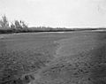
Yuma Project – Dry bed of Colorado River below Imperial Intake (1906)
-

The New River passes from Mexicali, Baja California, to the Imperial Valley, and on to the Salton Sea.
-

Abandoned, salt-encrusted structures on the Salton Sea shore at Bombay Beach
-

Salt deposits along the eastern shore of the sea
-
Toxic Salt ponds along the Western shoreline
-

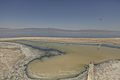
Aerial view of the Salton Sea from the north
-

A gaseous mud volcano
-

2002 satellite image of the Salton Sea with surrounding developments
-

Aerial view of the Salton Sea from the south
-

An abandoned boat stuck in the ground, close to the west coast marina of the Salton Sea


See also
 In Spanish: Lago Salton para niños
